Procore & DroneDeploy
Tech-driven, future-ready. We embrace the best tools in the industry to bring clarity, precision, and speed to every stage of construction.
We believe a great project doesn't just get delivered on time and on budget—it gets delivered safely. Safety is not a policy. It's our culture.
Construction that adapts, innovates, and delivers. Let's build your next commercial space the smart way.
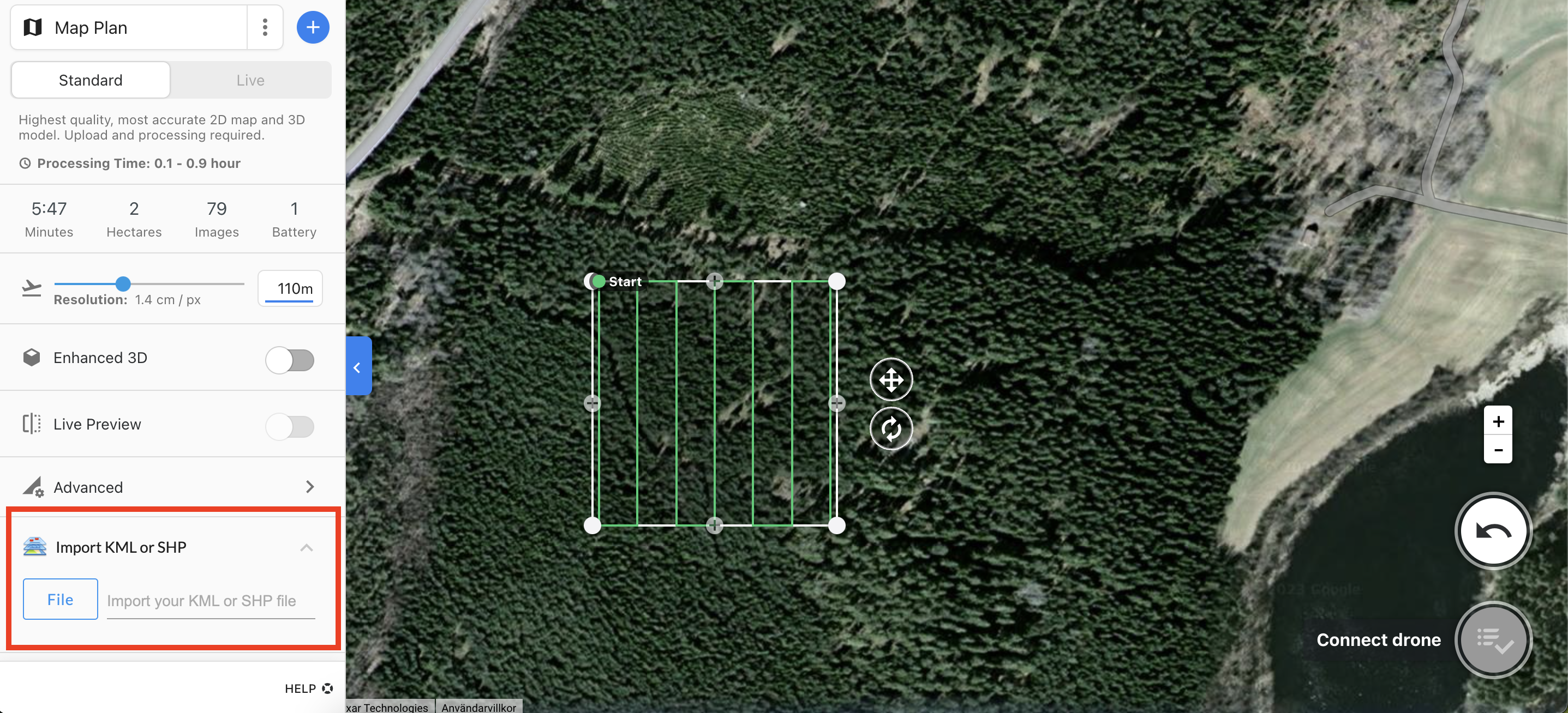
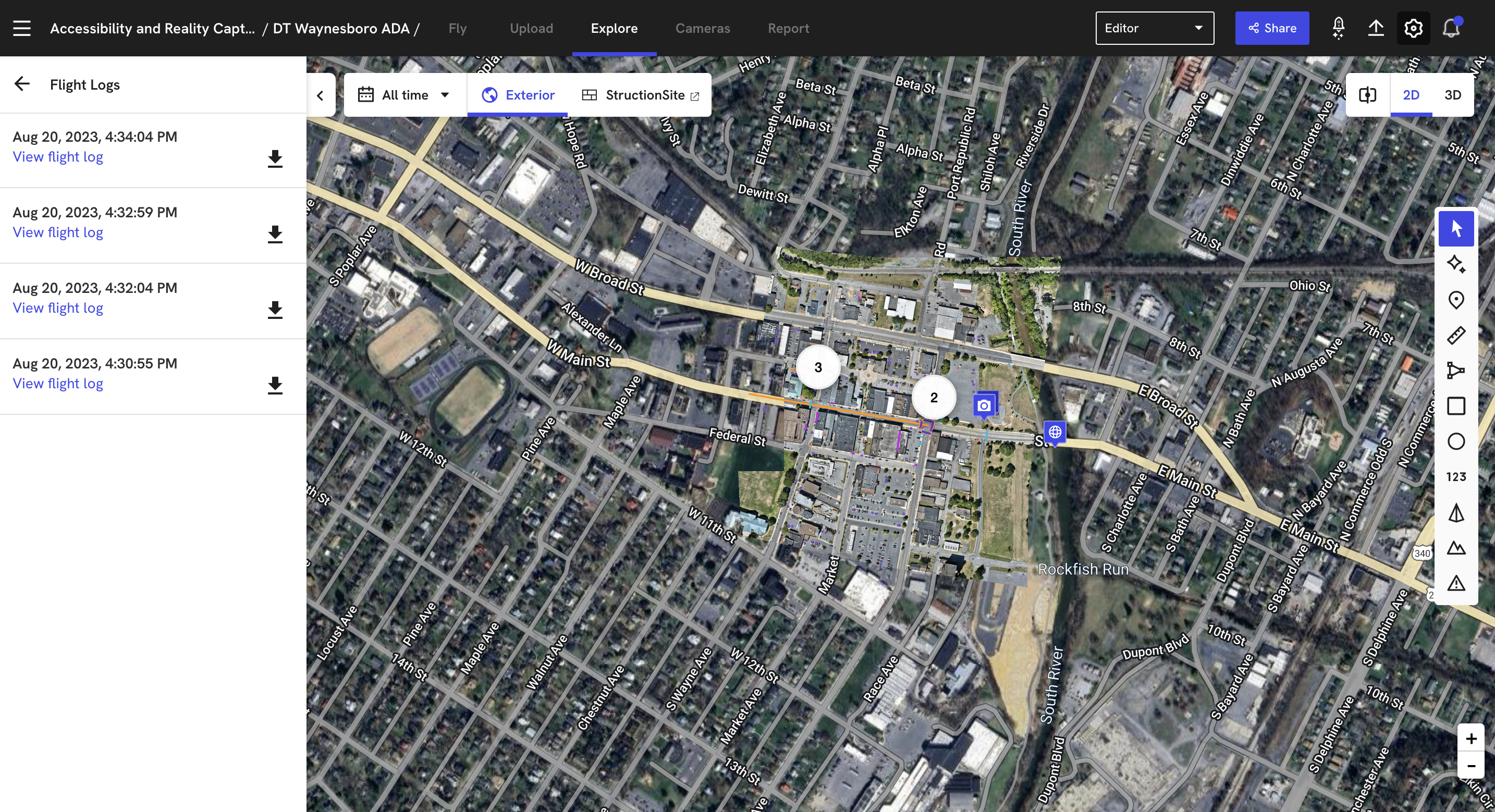
Drawing Overlays on Drone Maps
We overlay: site plans & boundaries, utility lines, measurements & CAD diagrams.
Why it matters: Compare design vs. real-time progress, detect risks early, improve team coordination.
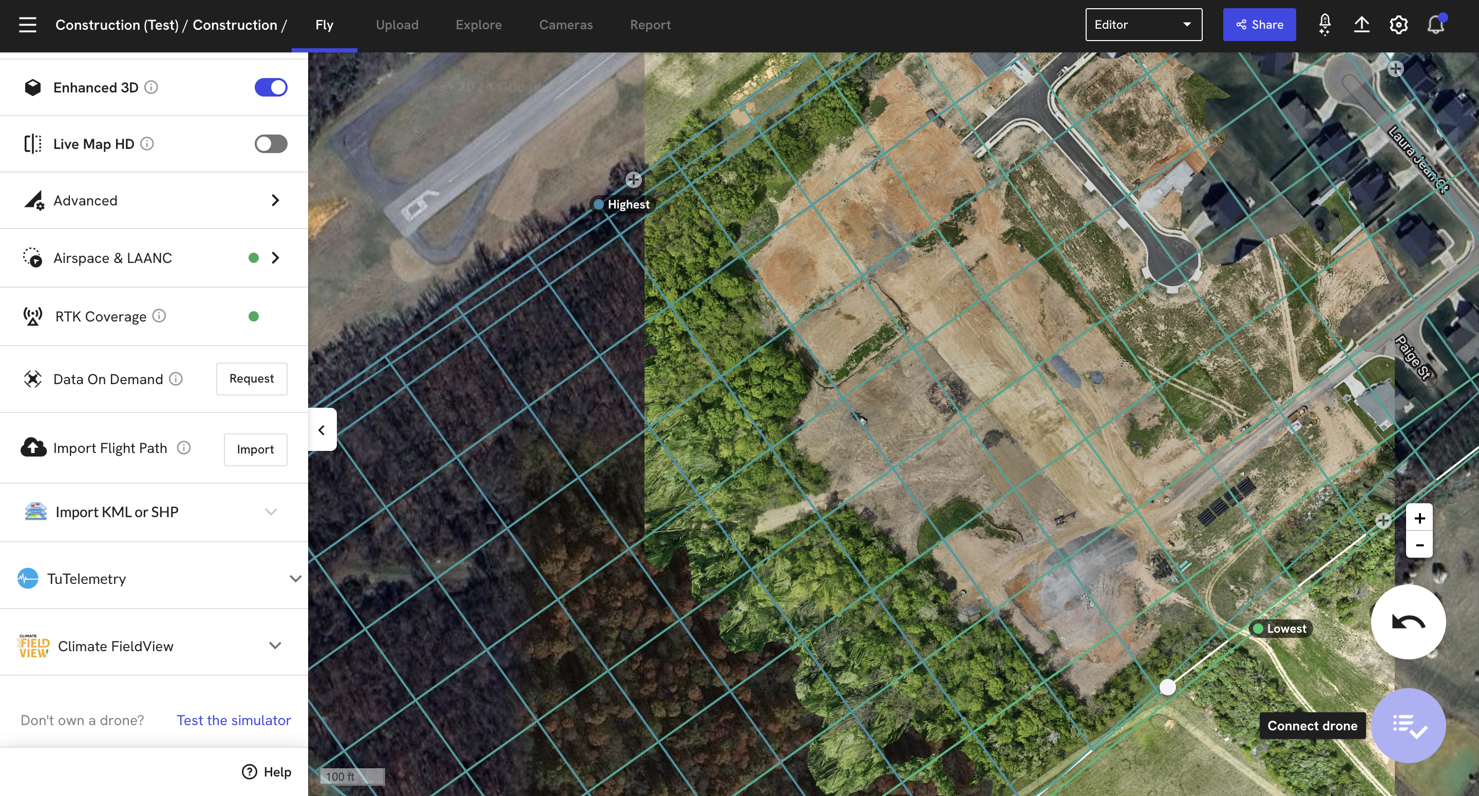
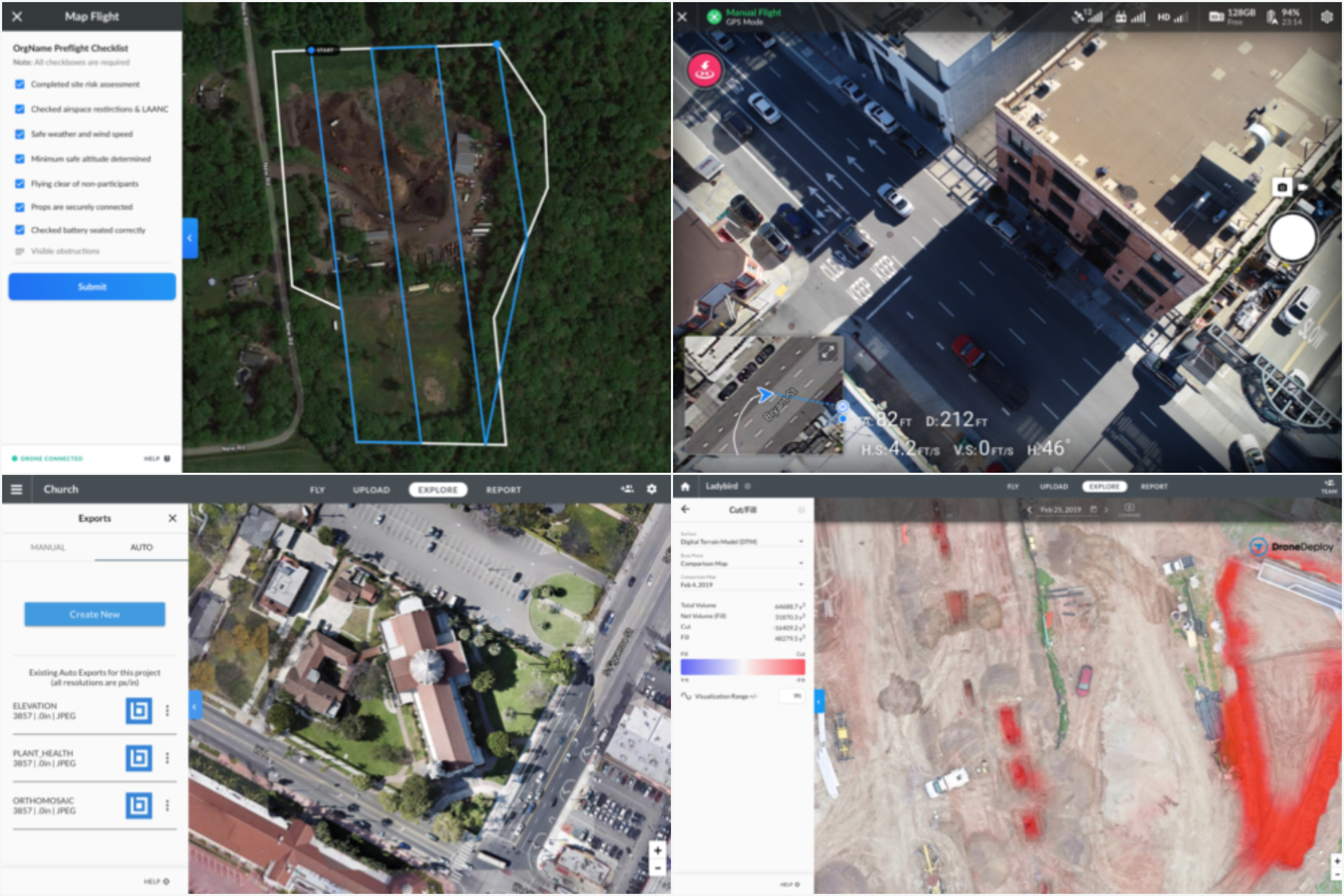
3D Modeling from Drone Flights
We generate high-accuracy 3D models from aerial imagery to optimize every phase of construction.
Outputs: 3D mesh models, point clouds, elevation maps & orthomosaics.
Key benefits: Faster data collection, detailed terrain & volume analysis, remote cloud-based access for better decision-making.
Procore & DroneDeploy
We add value to your projects by putting industry-leading technology in your corner: Procore for connected construction management and DroneDeploy for reality capture and AI-powered analytics. Our team uses this stack daily—so you get streamlined workflows, clearer visibility, and data-driven decisions without the learning curve. It’s how we deliver better coordination, fewer surprises, and stronger outcomes for owners and teams.
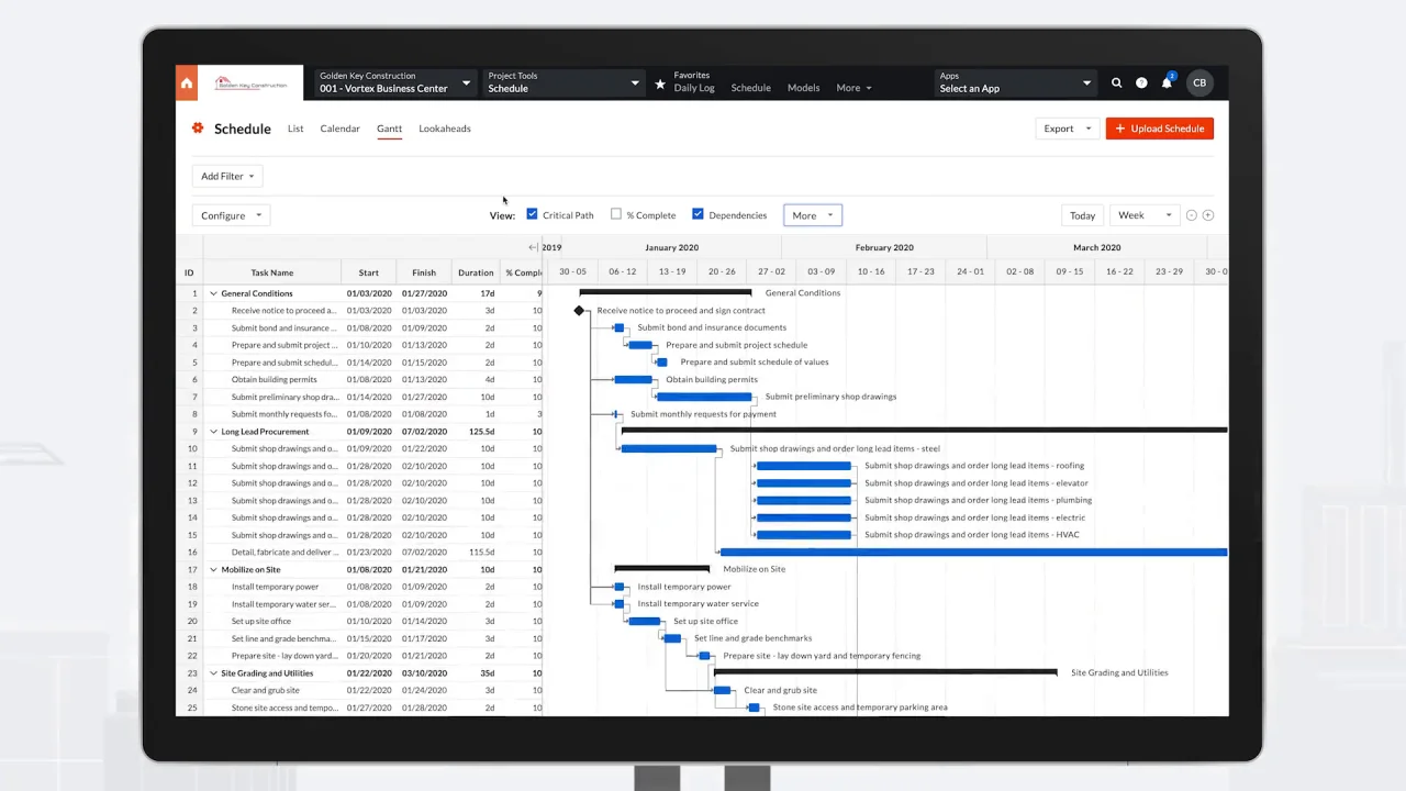
Procore
Comprehensive, cloud-based construction management software designed to connect project teams, owners, and general contractors on a single platform. Streamlines workflows like RFI management, drawings, and financial tracking, improving efficiency and reducing risk for over 10,000 customers.
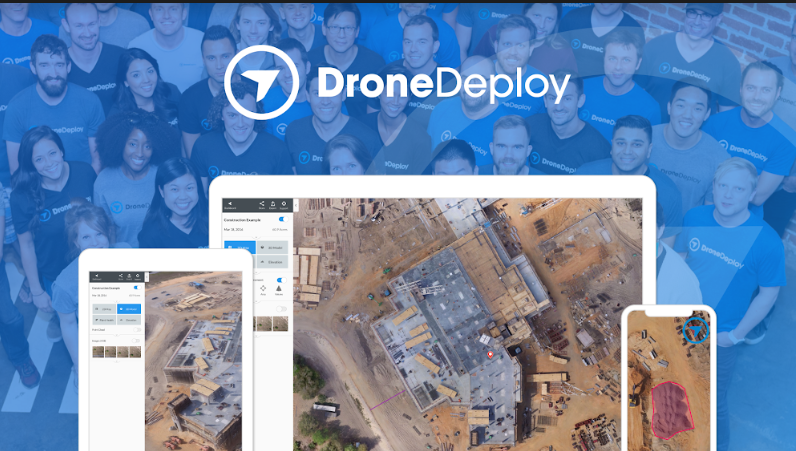
DroneDeploy
The leading reality capture platform combining drone mapping, 360-degree site documentation, and AI-powered analytics for construction, energy, and agriculture. Capture, analyze, and share site data from aerial drones, ground robots, and 360 cameras in one unified platform.
What We Offer
Procore
Procore is a comprehensive, cloud-based construction management software designed to connect project teams, owners, and general contractors on a single platform. It streamlines workflows like RFI management, drawings, and financial tracking, improving efficiency and reducing risk for over 10,000 customers.
- Connect project teams, owners, and GCs on one platform
- RFI management and drawing workflows
- Financial tracking and cost management
- Improved efficiency and reduced risk
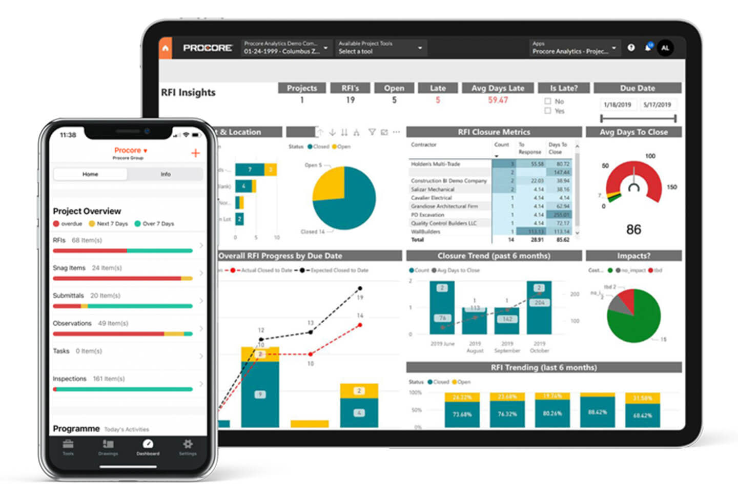
DroneDeploy
DroneDeploy is the leading reality capture platform combining drone mapping, 360-degree site documentation, and AI-powered analytics for construction, energy, and agriculture industries. Capture, analyze, and share site data from aerial drones, ground robots, and 360 cameras in one unified platform.
- Drone mapping and 360° site documentation
- AI-powered analytics
- Aerial drones, ground robots, and 360 cameras
- Construction, energy, and agriculture
Unified Workflow
Procore and DroneDeploy work together so reality capture and site data live alongside project documents, RFIs, and financials. One platform for capture, analysis, and construction management from design through handover.
- Photos and maps in Procore project files
- Progress tied to schedule and logs
- As-built and handover packages
- Owner and stakeholder access

Technology in Action